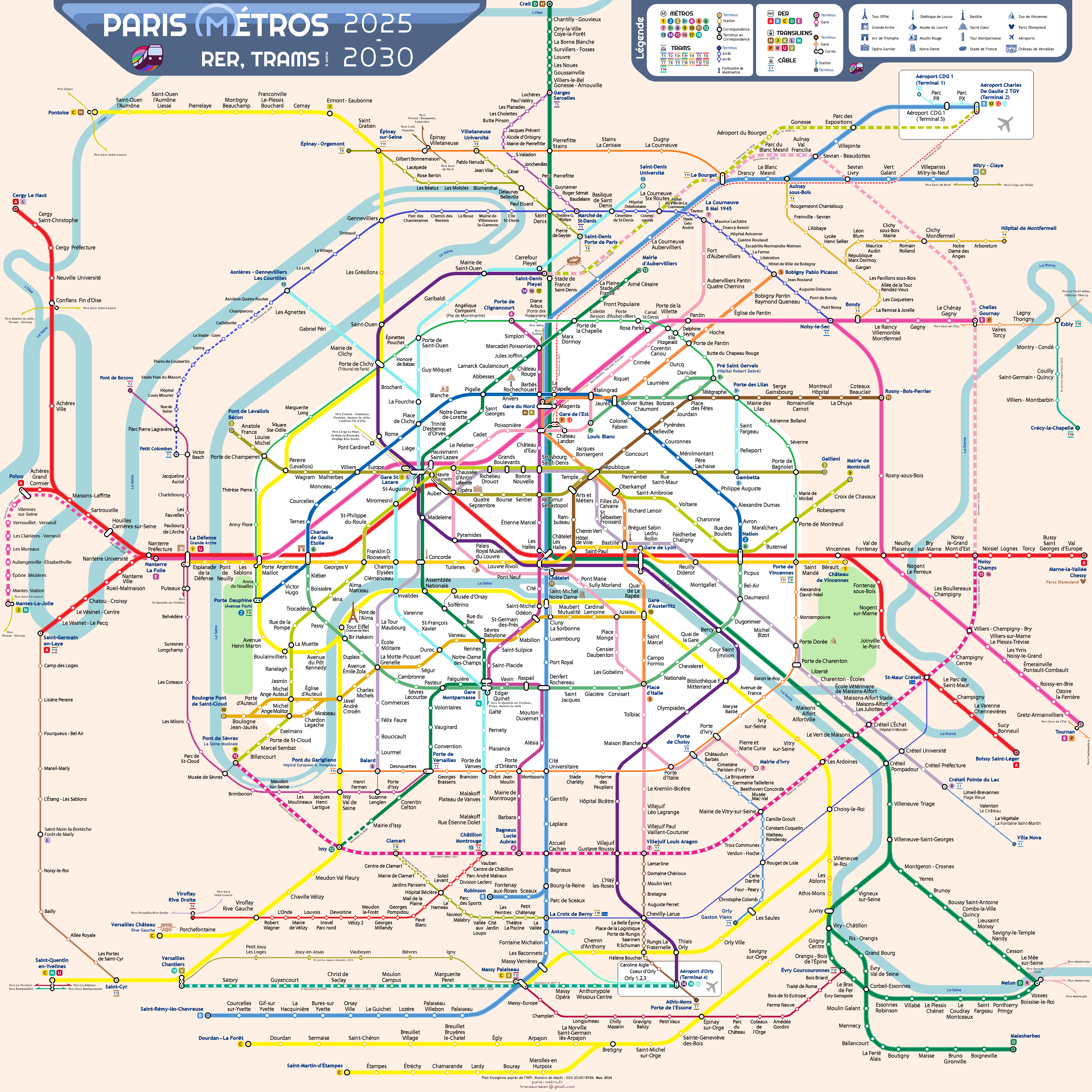
LAS VENTAJAS DE ESTE NUEVO MAPA DEL METRO, RER, TRANVÍAS Y OTROS TRANSPORTES DE PARÍS:
Crear un mapa único que se ha vuelto imprescindible para todos los francilianos, ya sean parisinos que viven dentro de la ciudad o residentes en la periferia de Île-de-France.
Organizar y simplificar una red extraordinariamente compleja.
Representarla de forma esquemática preservando los referentes geográficos apreciados por los amantes de París y su región.
Atreverse finalmente a adoptar los ejes lógicos norte-sur y este-oeste, que tienen sentido para todos los francilianos pero que hasta ahora no se habían aplicado.
Hacer que estos ejes, así como las líneas orbitales, sean reconocibles al instante con una sola mirada.
Permitir que nuevos usuarios y turistas se familiaricen rápidamente con la red.
Fomentar el uso del transporte público.
Ilustrar la libertad que se ofrece a los usuarios para explorar el área urbana de París y más allá.
Realzar París como se merece y distinguirla de otras grandes metrópolis del mundo.
Inscribir este mapa en la historia única del plano del Metro de París.